A massive El Niño event is rapidly forming across the Pacific Ocean — and scientists warn it could become the strongest in more than 150 years.
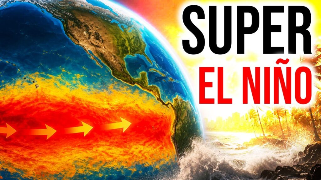
The biggest and most powerful El Nino weather event in 156 years!
That how scientists are describing a developing weather phenomenon that has become synonymous with floods, death and destruction, that is often followed by a long drought in Eastern Africa.
This time round, scientists also expect record breaking temperatures as the planet continues to heat up, spurring violent storms and other weather along the equator that would normally not be expected in this part of the world.
A prediction from the United States Climate Prediction Centre at the National Oceanic Atmospheric Administration or NOAA notes;
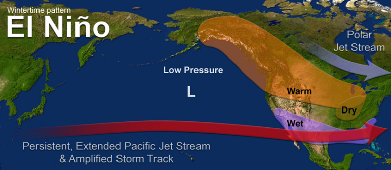
El Niño is a periodic warming of water in the central and eastern equatorial Pacific Ocean
El Niño is a periodic warming of water in the central and eastern equatorial Pacific Ocean that can affect global weather patterns for months. It disrupts normal wind patterns, causing global shifts in temperature and rainfall that trigger extreme weather—from severe droughts in some regions to catastrophic flooding in others.
In East Africa, El Nino is synonymous with massive spike in rainfall, causing devastating floods, landslides and destruction of infrastructure. It often followed by drought which hits the country’s agricultural economic backbone, causing massive crop failure and killing off livestock herds. Its effects are often felt in a spike of food prices, driving inflation.
The prognosis this time is not good.
Writing for the US based Weather channel on weather.com, senior meteorologist Jonathan Erdman writes that he expects a ‘super El Nino’.
‘This won’t be your garden-variety El Niño… the latest outlook suggests there is an almost 60% chance this El Niño could become strong by fall, and at least a one-third chance it could become a “super El Niño,” one in which ocean surface temperatures are at least 2 degrees Celsius warmer than average,’ he writes.
According to him, there have been 27 El Niños since 1950, with one happening on average every three to four years. The last one happened from summer 2023 into early spring 2024.
Super El Niños are rarer.
There have been only five since 1950, the last occurring 11 years ago from 2015-16. They also occurred in 1997-98, 1991-92, 1982-83 and 1972-73. Super El Niños have also been documented in 1888-89 and 1877-78.
The 1997-1998 El Nino is well remembered in Kenya. It not only caused massive floods and landslides but also destroyed infrastructure to the point where Kenya needed World Bank intervention to recover.
The European Centre for Medium-Range Weather Forecasts cast a much gloomier picture, with its dire prediction putting the probability for a super El Nino event at 100%.
Speaking to HuffPost UK, Prof Bill McGuire, a professor specializing in climate hazards, said: “El Niño is a climate phenomenon that develops every few years, and which involves the eastern and central equatorial Pacific Ocean becoming hotter than normal.”
“During a normal El Niño, the temperature of the equatorial Pacific Ocean typically reaches 0.5°C or more above normal. If this figure reaches 1.5-2°C, the event is described as a super El Niño.
“The most extreme El Niño ever recorded happened in 2015-16, when the sea temperature exceeded 2.5°C. Broadly speaking, the bigger the El Niño, the greater its impacts on the world’s weather.”
This time round, Central Pacific temperatures are projected to exceed 3°C above average, a level of oceanic heat not seen since the historic 1877 event.
Liz Stephens, professor of climate risk and resilience at the University of Reading told the BBC that we’re “probably be looking at record global temperatures next year, especially if this is a very strong El Nino event”.
‘Following the 2023/24 El Niño we saw the hottest year on record. While you might see more direct weather impacts around the Pacific, every El Niño is unique in terms of its strength and how far reaching its disruption is to global weather patterns. Flooding in northern Peru and southern Ecuador is common but also potentially in East Africa, Central Asia and southern portions of North America.’
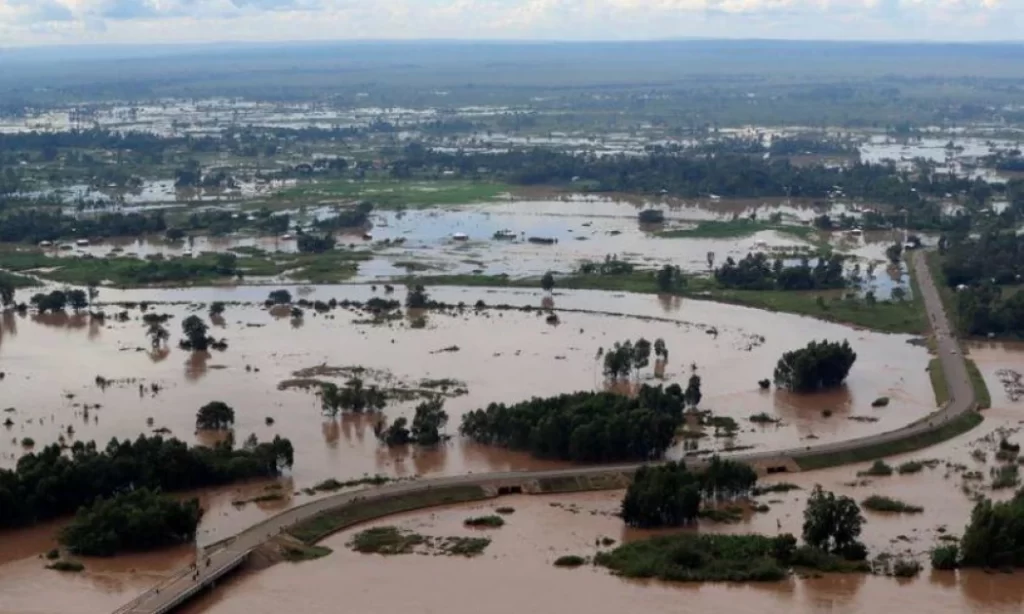
‘There is also a greater chance of drought and wildfires in parts of Australia, Indonesia and the north of South America, leading to a decline in agriculture and global food stocks.’
For many Kenyans, the starting of El Nino later in the month or possibly as the year goes on means they will be between a rock and a hard place. With the war in the strait of Hormuz driving record prices for fuel and other inputs, any new shock may be the proverbial straw that breaks the camel’s back.
But with a newly revamped National Disaster management Centre under the seasoned Dr. Duncan Onyango Ochieng, the gaps that have occurred in the disaster preparedness response in the past may become a thing of the past.
Netizens online have however rang a warning bell and questioned whether the country will prepared in time.
@ephraimnjegafan noted:
‘As usual, we shall start reacting in 2027 when it will be already too late. A super el Nino is currently brewing and this one could spell disaster for this nation. We need to prepare for a massive drought starting October and running all the way to mid 2027. The rains WILL fail.’